 Gallery


HowTo Video Tutorial – Valarm Tools Cloud with 3D Esri ArcGIS
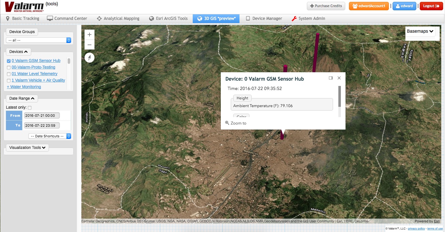
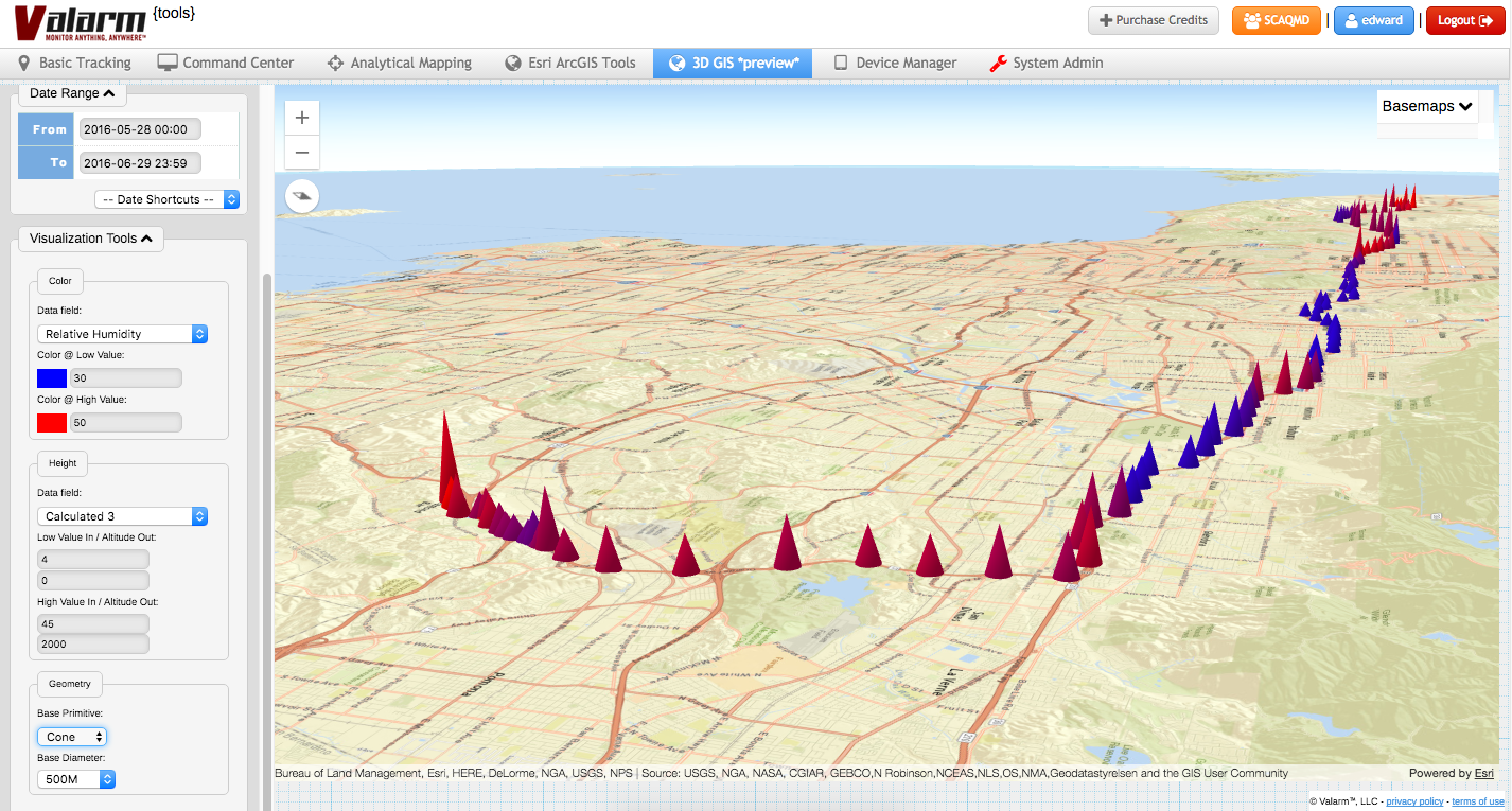
3D GIS Earth Globe Map Visualizations Meet Industrial IoT, Remote Sensor Monitoring, and Real-Time, [...]
3D GIS Earth Globe Map Visualizations Meet Industrial IoT, Remote Sensor Monitoring, and Real-Time, [...]


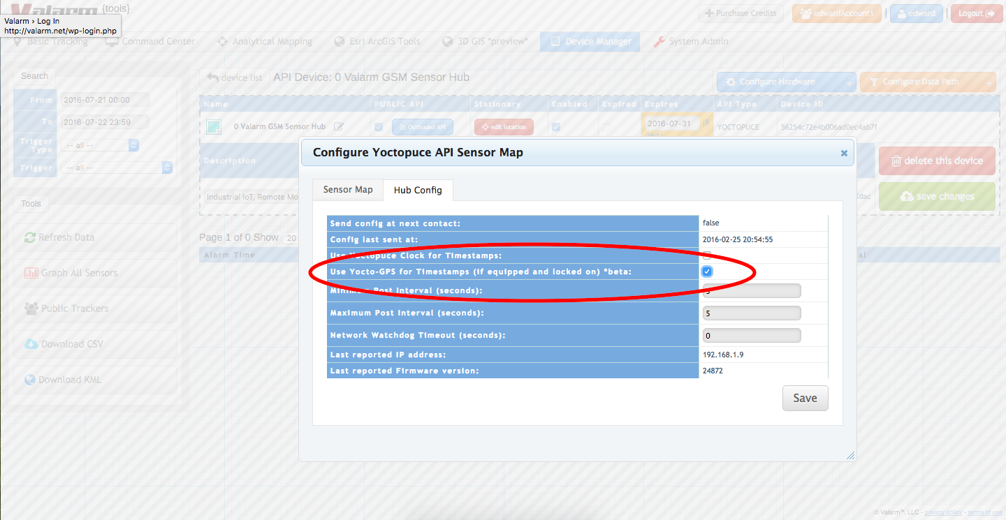
You need to keep good track of time for your Industrial IoT applications.
When you’re [...]


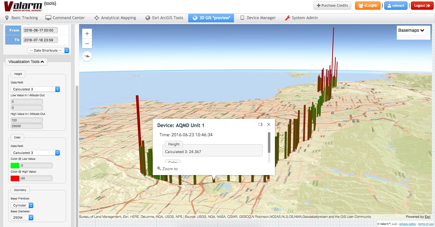
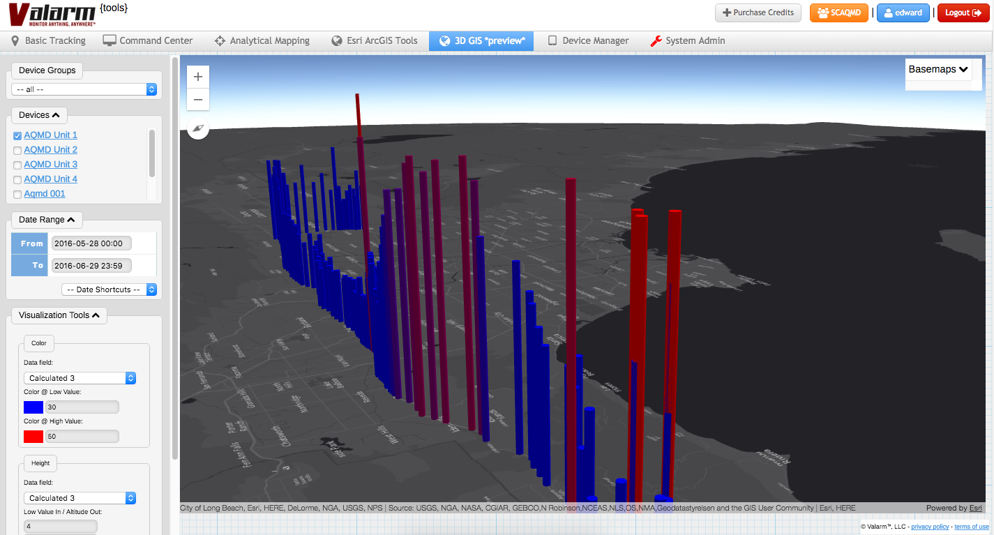
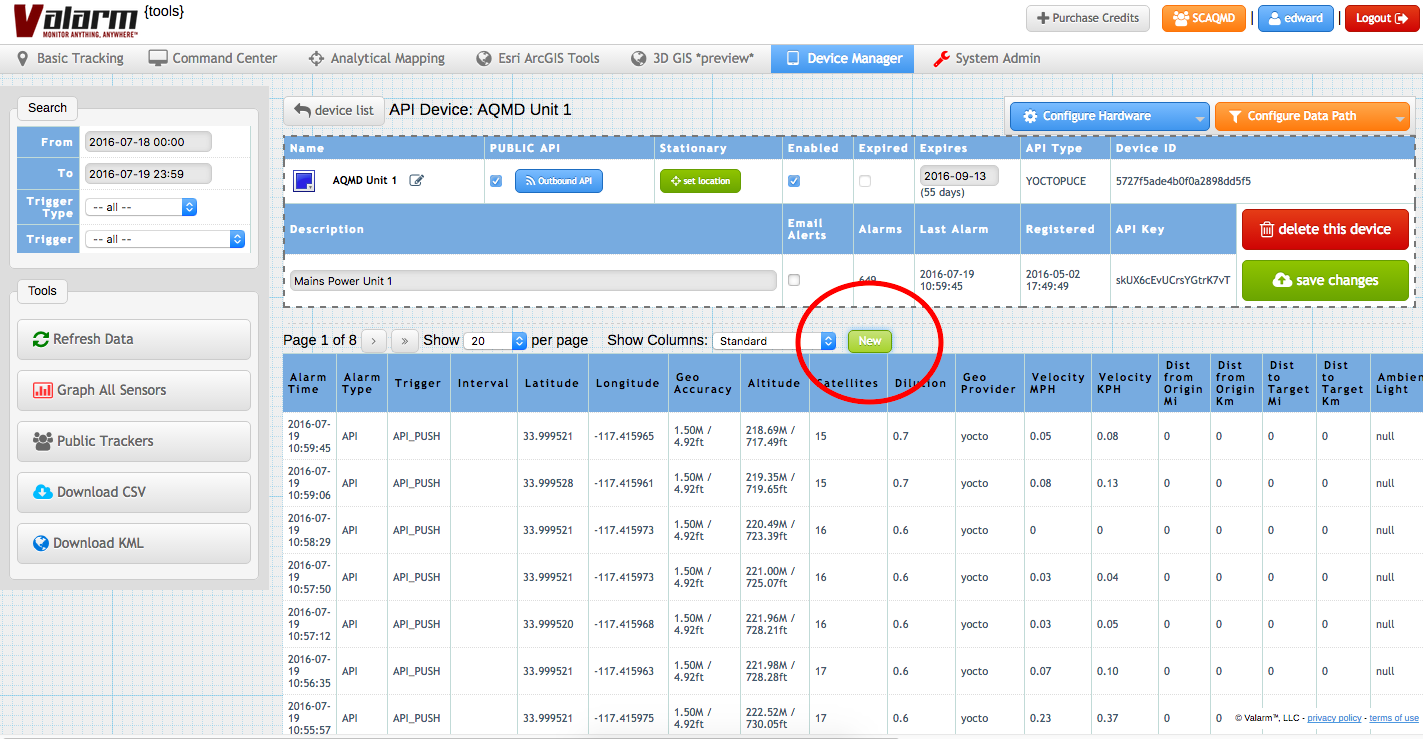
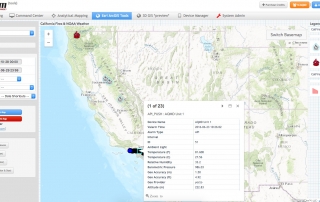
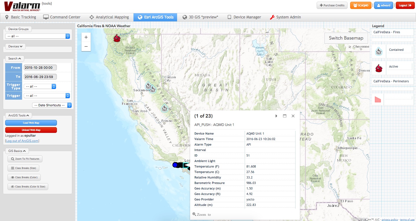
Does your organization need to remotely monitor air quality?
How about Particles [...]


How accurate do timestamps need to be for your organization’s Industrial IoT applications? If you’ve [...]
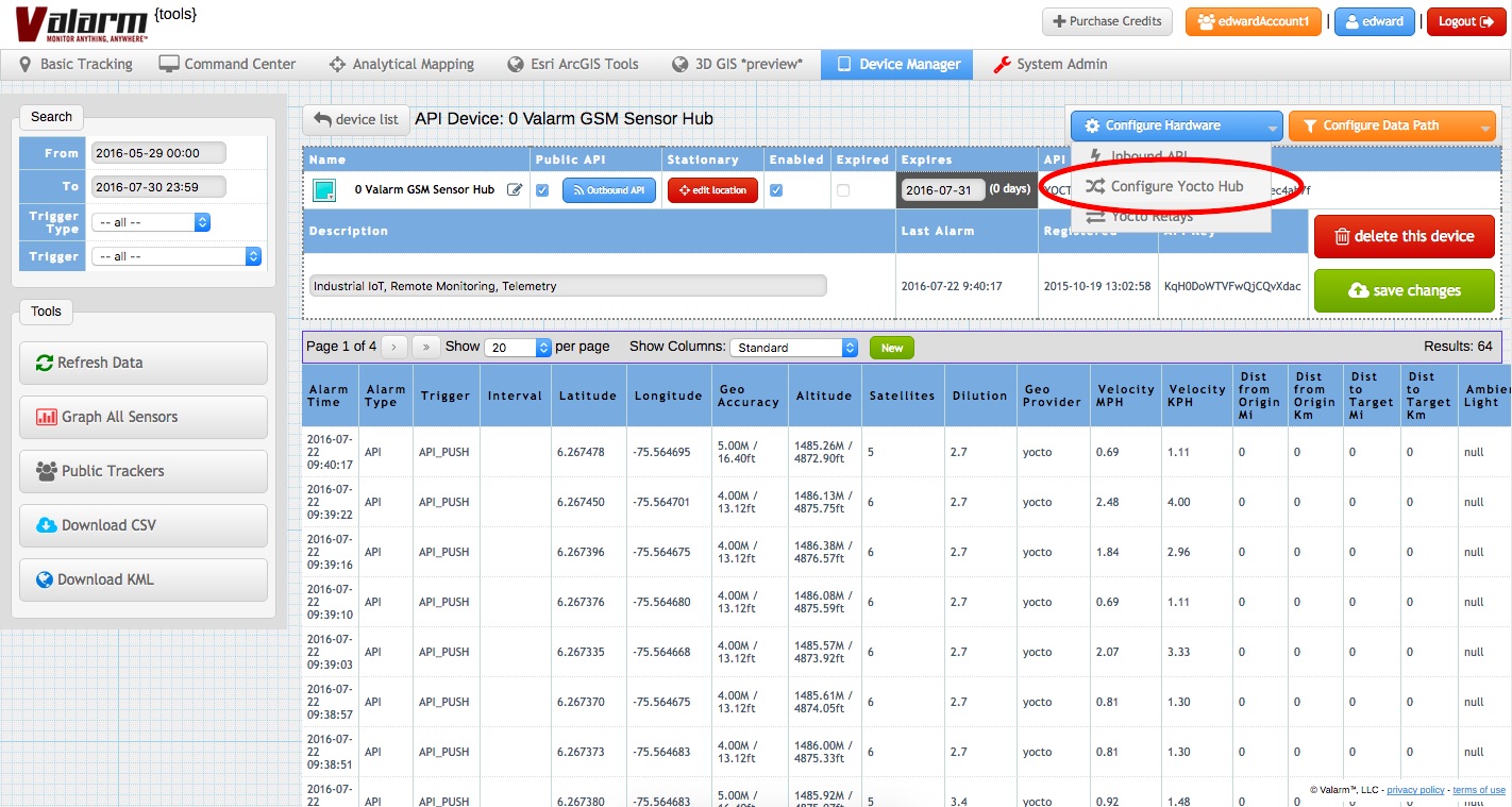
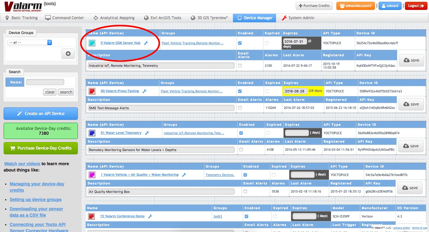
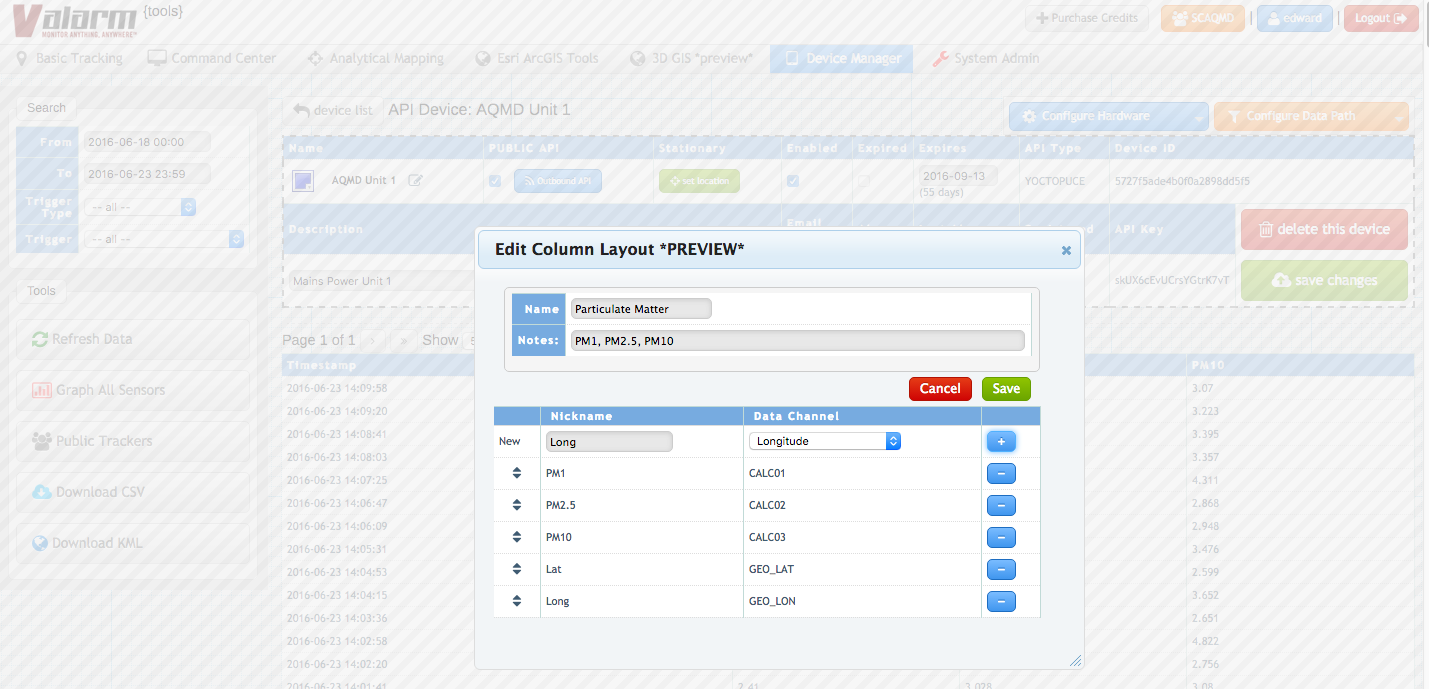
Would you like to change a sensor field name? Do you have sensor hubs and [...]


You or your organization need to remotely monitor air quality and particulate matter?
For each [...]


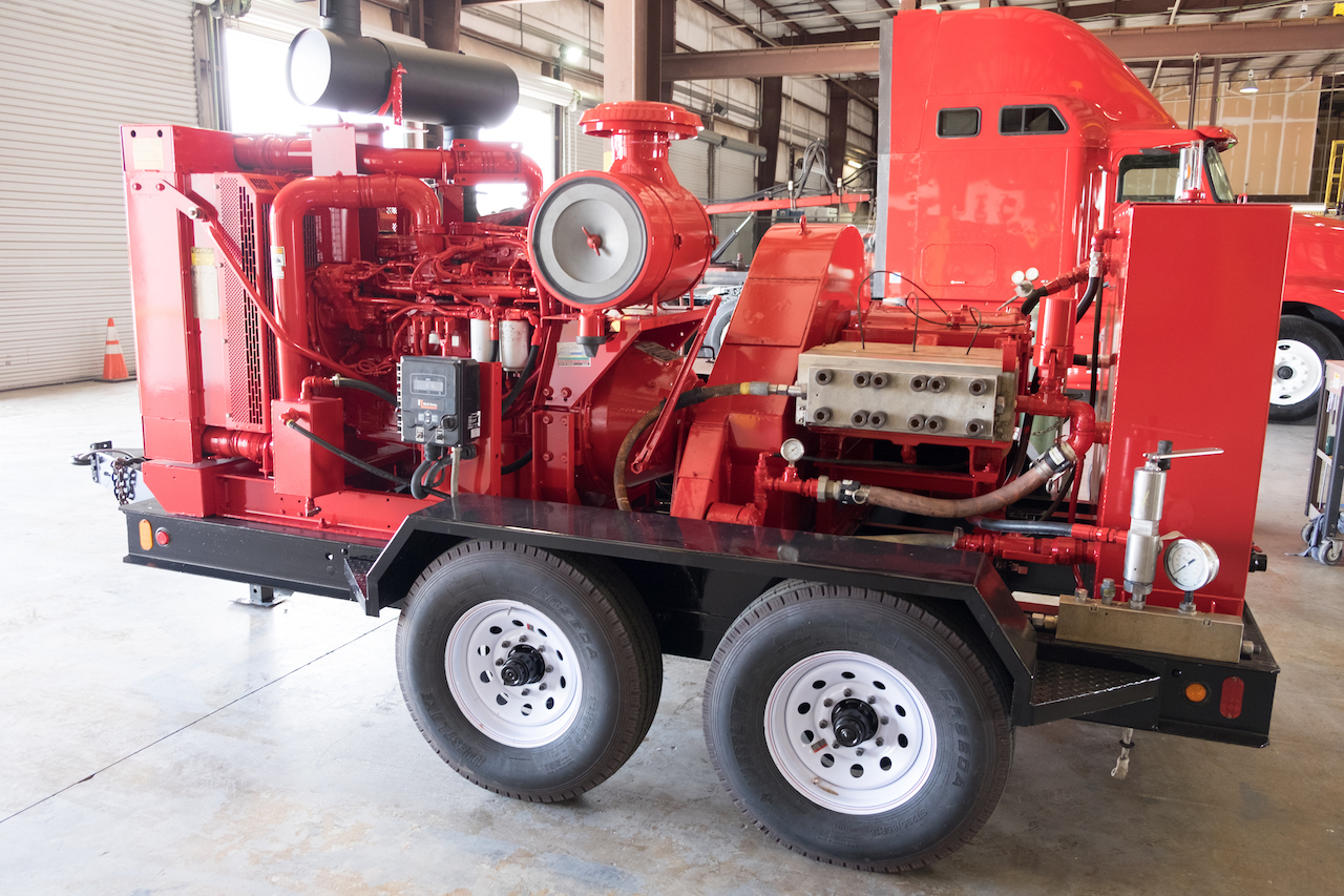
Industrial IoT Remote Sensor Monitoring Meets Fleet Tracking for Industrial Vehicles
You can find [...]


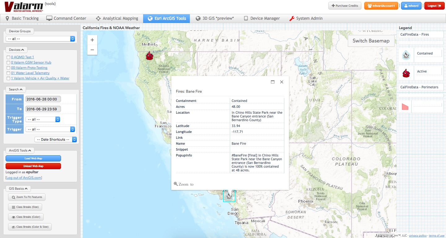
What’s your newest Tools.Valarm.net feature? We’ve added integration with Esri ArcGIS Online a.k.a. arcgis.com!
You can now bring [...]


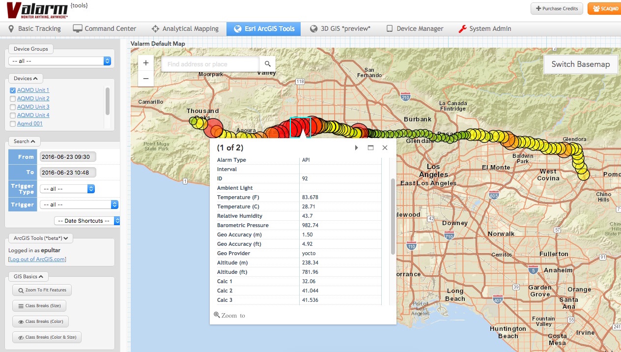
You can now visualize your Valarm Industrial IoT sensor information in 3D the next [...]

This week we’re at the Esri Arc GIS User Conference in San Diego. There are [...]

 Gallery


 Gallery


 Gallery


 Gallery


 Gallery


 Gallery
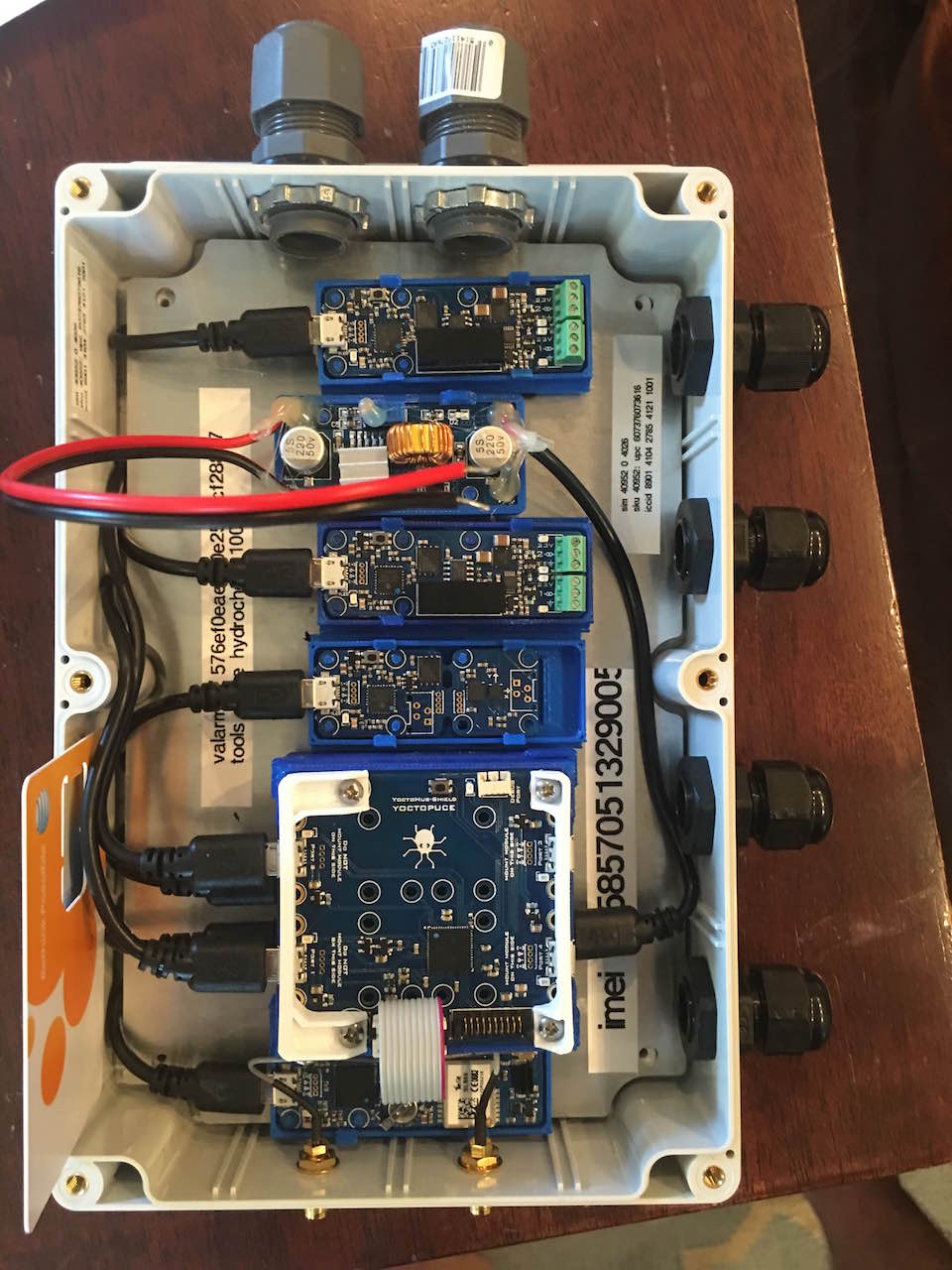
 Gallery

 Gallery


