 Gallery


HowTo Video Tutorial – Valarm Tools Cloud with 3D Esri ArcGIS
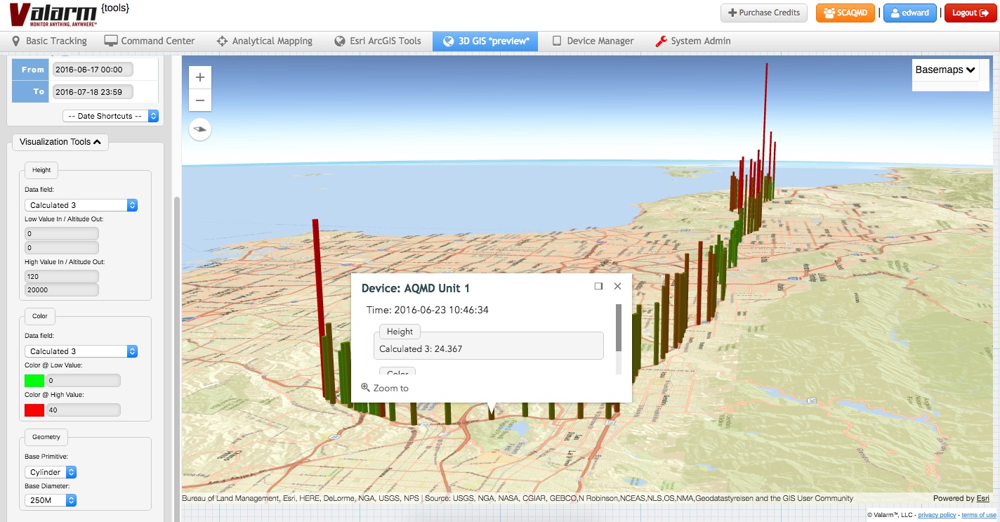
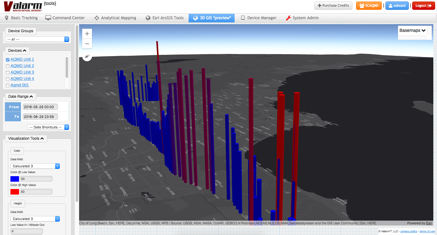
3D GIS Earth Globe Map Visualizations Meet Industrial IoT, Remote Sensor Monitoring, and Real-Time, [...]
3D GIS Earth Globe Map Visualizations Meet Industrial IoT, Remote Sensor Monitoring, and Real-Time, [...]


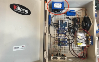
You or your organization need to remotely monitor air quality and particulate matter?
For each [...]
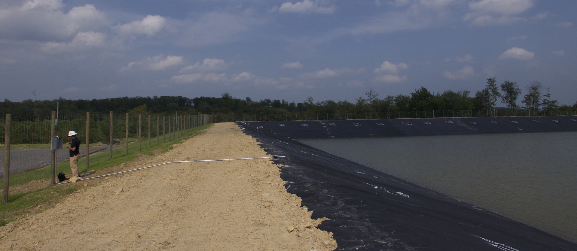
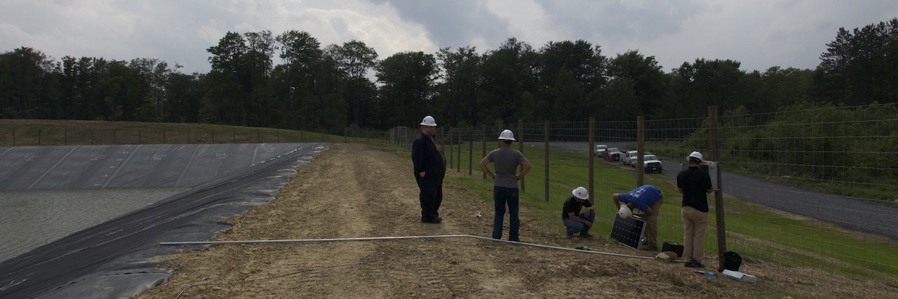
New tools will help Louisiana understand crucial water issues. The development and management of dams [...]


IoT is all the rage with consumers today. What’s with this new IIoT, a.k.a., [...]


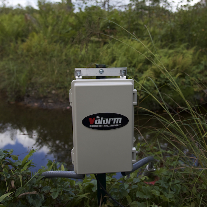
How do you monitor groundwater volume and groundwater availability?
It’s hard to know what’s going [...]
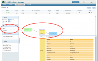


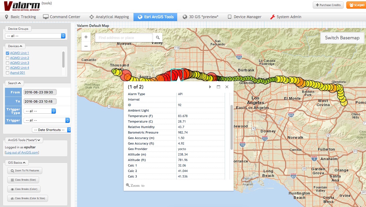
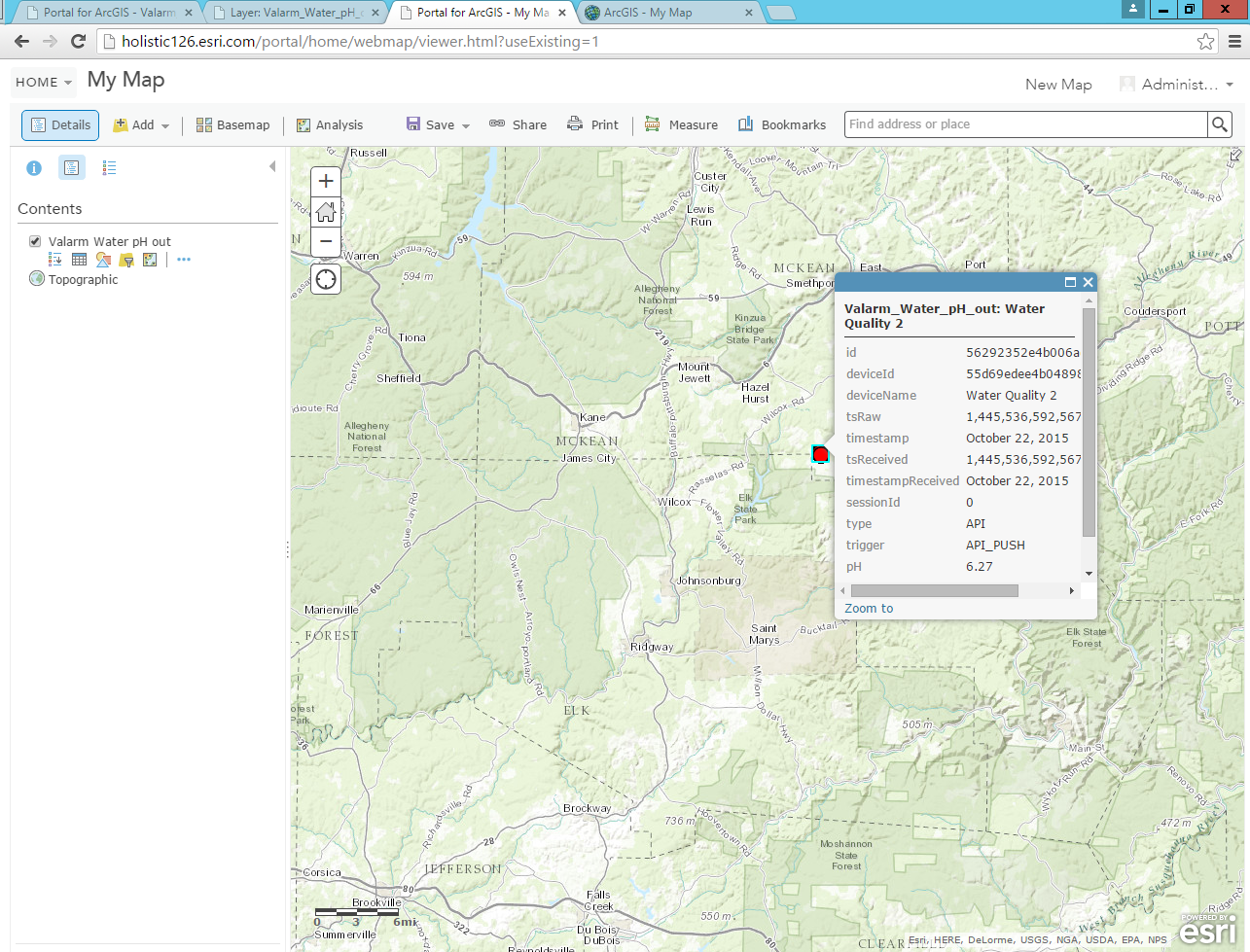
How do you bring your Valarm sensor data into the Esri ArcGIS platform?
The easiest [...]
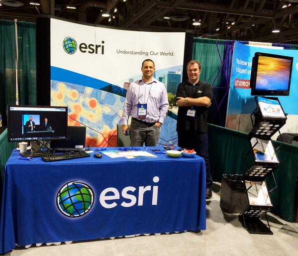
2015 is Valarm’s 3rd straight year at the Esri User Conference in San Diego – [...]
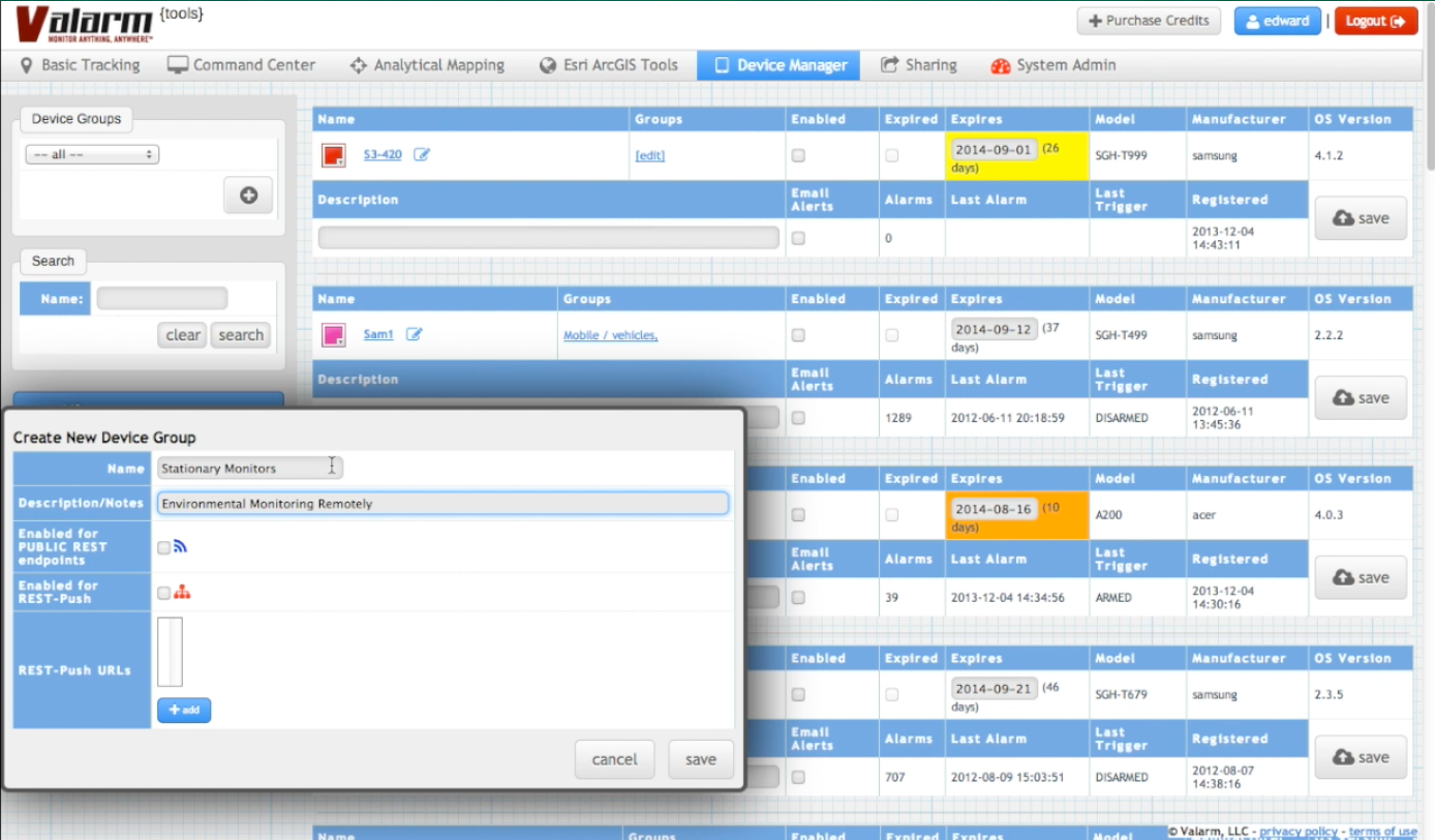
You want to learn more about Device Groups in the Valarm Tools Cloud? This [...]
UPDATE:
Have a look at our Air Quality Monitoring Overview Page!
Also take a gander [...]
We went to our first Air & Waste Management Association (AWMA) conference this spring. [...]
 Gallery
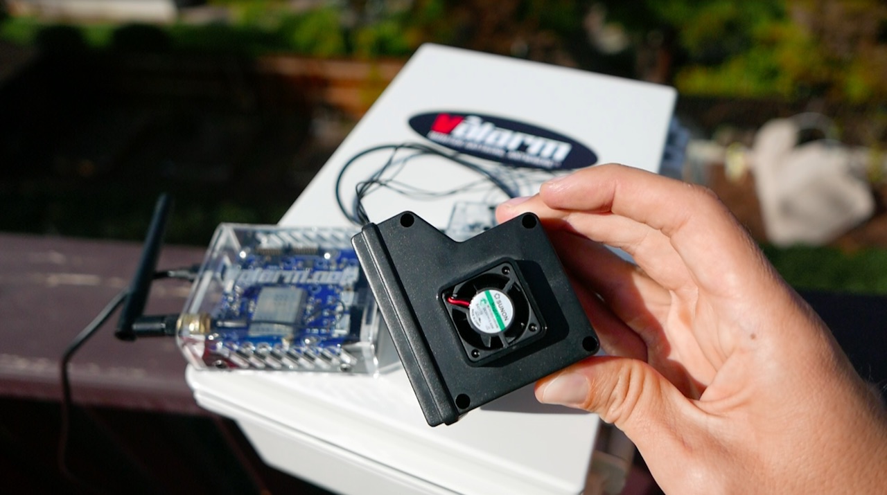


 Gallery


 Gallery


 Gallery


 Gallery


 Gallery


 Gallery
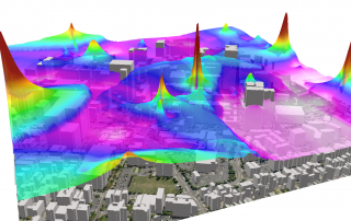
 Gallery
 Gallery

