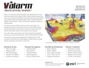
Tools.Valarm.net monitors helicopters.
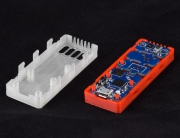
Use Tools.Valarm.net with your sensor hubs for data acquisition and real-time monitoring of any water, industrial equipment, asset, vehicle, or helicopter you have.

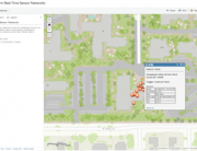
Remote monitoring with Tools.Valarm.net in a helicopter.

You can see the helicopter’s current location and sensor data on a map at Tools.Valarm.net.

Helicopter loops! You can also do historical mapping and analysis with Tools.Valarm.net Industrial IoT software tools.

Mobile sensor data acquisition and remote monitoring with Valarm in the cockpit.


Hi – It seems like a helicopter would already have GPS tracking? Why is Valarm useful in this scenario?
Howdy Jim, some data collection devices used on helicopters can interfere with other built-in GPS tracking devices. Valarm provides location data that works in those scenarios (just try it out!) and uses any internet connection to put position and other sensor data on the web or in a text message. Cheers.